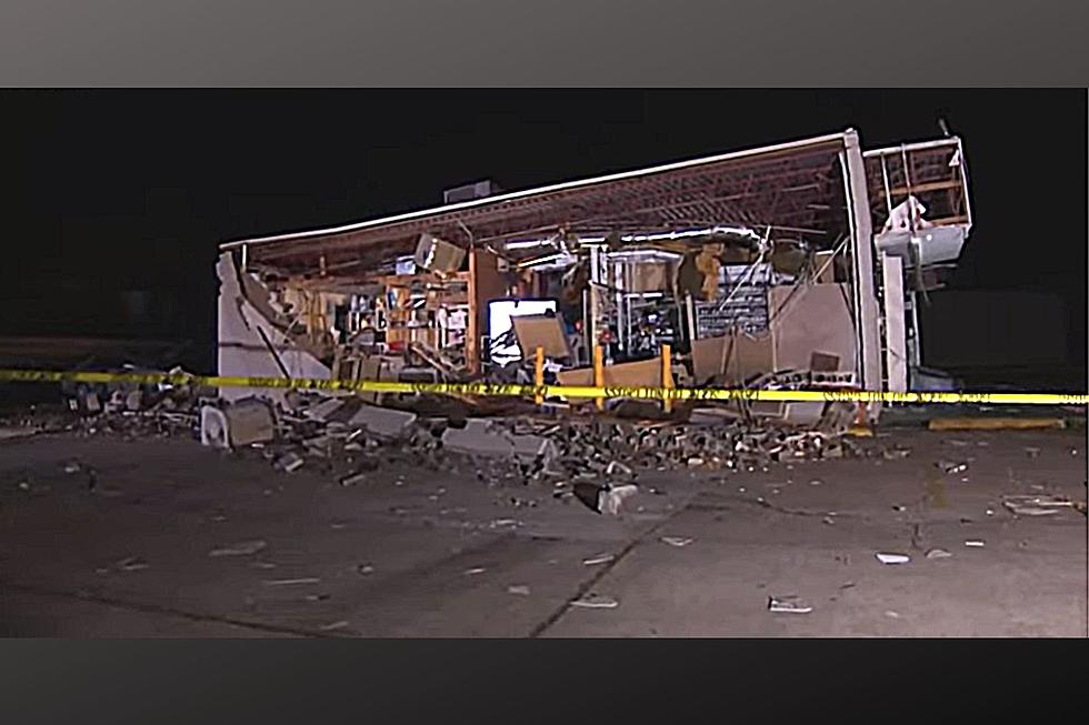
Strong Thunderstorms Could Impact the Crossroads This Weekend
Showers and Thunderstorms are headed into the Crossroads as we wrap up the workweek. The National Weather Service in Corpus Christie says that along with some of these storms will come the chance for severe weather.
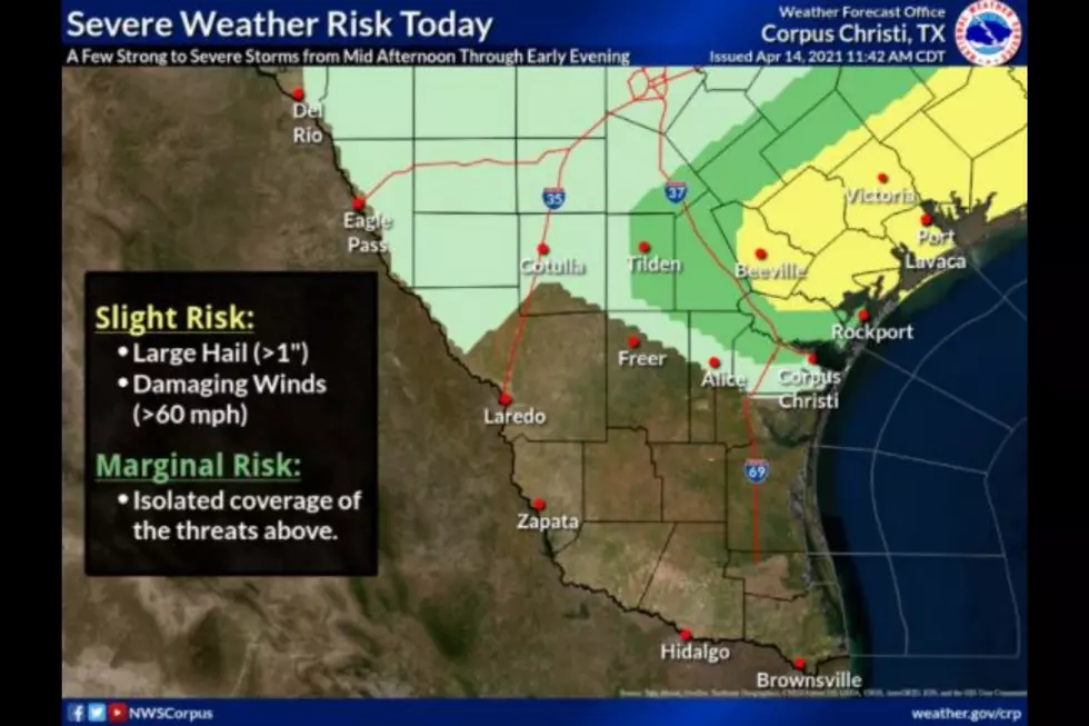
Today/Tonight: Scattered thunderstorms will increase in coverage over the area as we head into Friday evening. While several storms are expected to pass through the area tonight there is only a slight risk at this time for storms to become severe. While the risk for severe weather is low to moderate, increased rainfall could lead to flooding in our local creeks and rivers. This is especially likely as more thunderstorms are expected in our area on Saturday.
If you are beach bound today or over the weekend know that the National Weather Service is advising the public to be on the lookout for rip currents as the risk will be high along all gulf-facing beaches today and tomorrow.
Saturday: Scattered Showers and Thunderstorms will continue on Saturday with additional heavy rain likely in the Crossroads. Rip Current risks will remain high for south Texas on Saturday.
Overall 2 to 3 inches of rain is expected over much of the area by the end of the weekend. With 60mph winds expected with some of these storms, you'll want to be sure you have things packed away in the yard if they could be carried off by the wind. Nothing like finding your lawn chairs 2 streets over by Sunday morning. Use caution when traveling in heavy rains to avoid hydroplaning.

CHECK IT OUT: Here's how to stop your glasses from fogging while wearing a face mask
More From KLUB Tejano 106.9